21 DARTMOUTH RD
Owner Information
WILLIAMS JOHN J
21 DARTMOUTH RD
MARBLEHEAD, MA 01945-2107


Property Details
21 DARTMOUTH RD is classified as a Single Family Residential (Cape).
The primary structure on this property was built in 1945. There are 2,030ft2 of built area within this property. There is 2,030ft2 of residential/living space within this property. This property is listed as having 8 rooms.
21 DARTMOUTH RD is valued at $617,400. The land is valued at $446,300 and the structures are valued at $171,100.
This property is in Zone SR. Confirm with local Zoning Board authorities to ensure there are no overlays or other easements on this property.
The most recent deed for 21 DARTMOUTH RD is recorded at the local registrar in Book 9481, Page 385. 21 DARTMOUTH RD was last sold on Friday, April 22, 1988 for $262,000.
Assessment data from fiscal year 2022.
Flood Data
According to the FEMA National Flood Hazard Layer, this property does not appear to be in a flood zone. It may also be in an area not yet reviewed. Nonetheless, confirm this information prior to taking any action.
To view the flood hazards around this property, create a FEMA "Firmette" Map of the area around 21 DARTMOUTH RD.
Broadband Internet Providers
| Provider | Type | Bandwidth (mbps) | |
|---|---|---|---|
| T-Mobile | Fixed Wireless | 25 | 3 |
| GCI Communication Corp. | Satellite | 0 | 0 |
| HughesNet | Satellite | 25 | 3 |
| Viasat Inc | Satellite | 100 | 3 |
| Verizon New England Inc. | Fiber | 940 | 880 |
| Comcast | Cable | 1000 | 35 |
| VSAT Systems, LLC. | Satellite | 2 | 1 |
Broadband service provider data from December 2020.
Adjacent Properties
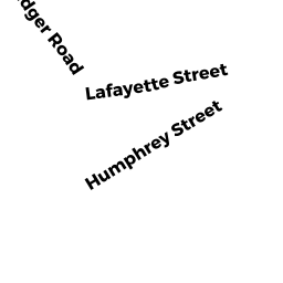
- 7 9 WIDGER RD
Improved, Selectmen or City Council (Municipal) owned by TOWN OF MARBLEHEAD - 1 WIDGER RD
Medical Office Buildings owned by NORTH SHORE MEDICAL CTR INC - 15 DARTMOUTH RD
Single Family Residential owned by TENTINDO MICHAEL J TRUSTEE - 25 DARTMOUTH RD
Single Family Residential owned by WILKENS JAMES T